20100712 04 Flood Muotathal SZ: Unterschied zwischen den Versionen
Zur Navigation springen
Zur Suche springen
Kaiko (Diskussion | Beiträge) |
Kaiko (Diskussion | Beiträge) |
||
| Zeile 58: | Zeile 58: | ||
© Meteoradar / Quelle: [http://www.metradar.ch/2009/pc/index.php Donnerradar] (kostenpflichtig)<br/><br/> | © Meteoradar / Quelle: [http://www.metradar.ch/2009/pc/index.php Donnerradar] (kostenpflichtig)<br/><br/> | ||
[[File:20100712 04 Flood Muotathal | [[File:20100712 04 Flood Muotathal SZ_loop02.gif|560px]]<br/><br/> | ||
[[File:20100712 04 Flood Muotathal | [[File:20100712 04 Flood Muotathal SZ_loop01.gif|560px]]<br/> | ||
© Meteoradar | © Meteoradar | ||
[[File:20100712 04 Flood Muotathal SZ_animation.gif|800px]]<br/> | [[File:20100712 04 Flood Muotathal SZ_animation.gif|800px]]<br/> | ||
Version vom 11. Februar 2018, 19:02 Uhr
Quick Facts
| Type of Event | Flash Flood |
|---|---|
| Verification State | QC1 |
| ESWD | Not reported |
| Location | Muotathal (SZ), Ibergeregg (SZ), |
| Time / Duration | Approx. 16.30 - 17.30 UTC |
| Date | 12.07.2010 |
| Magnitude / Dimension | > 50mm of rain in 1 hour |
| Damage | Flooded streets and maedows |
| Fatalities | - |
| Injuries | - |
| Report Source | Newspaper report, photos |
| Remarks | - |
Ereignis
Folgt
Bilder
Folgen
Radarbilder
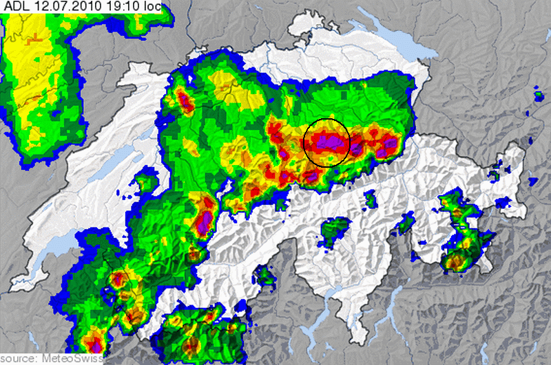
Nachfolgend eine Animation von Radar-Einzelbildern im 5 Minuten Intervall
über die gesamte Dauer des Ereignisses (18.15 Uhr bis 19.30 Uhr MESZ) - mit Markierung Muotathal

© Meteoradar

© Meteoradar / Quelle: Donnerradar (kostenpflichtig)
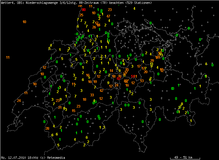
Messdaten
Betroffene Gewässer
Bettbach,
Videos
© 1940sand
Medienlinks
Diskussion im Sturmforum Schweiz:
NOW: Unwetterphase 3. Tag: 12.07.2010
Interna
| SSWD Main Editor | Kaiko | Last Edit | 11.02.2018 | Last Review | - | Documentation State | Draft |
|---|


